

02 · Gaussian splat
An explorable, photoreal 3D scene.
Simsara Aerial · Drone & ground 3D capture
Stockpile volumes, well pad records, construction progress and relightable 3D for quarries, energy sites and builders in southwest PA and beyond.
Drone & ground 3D capture.
Part 107 certification status: unconfirmed · Cert # [PART 107 CERT #] · Insurance status: unconfirmed [INSURANCE] · Based in Farmington, PA 15437 · Serving PA, WV, OH, MD & VA (about 300 mi radius, farther by air)
Services
Every flight is planned as a dataset: captured on a repeatable route, aligned to real-world coordinates and finished with the tools of a VFX studio. Subpixel-aligned reconstructions with millimeter-level detail, and survey-grade accuracy when tied to ground control or RTK.
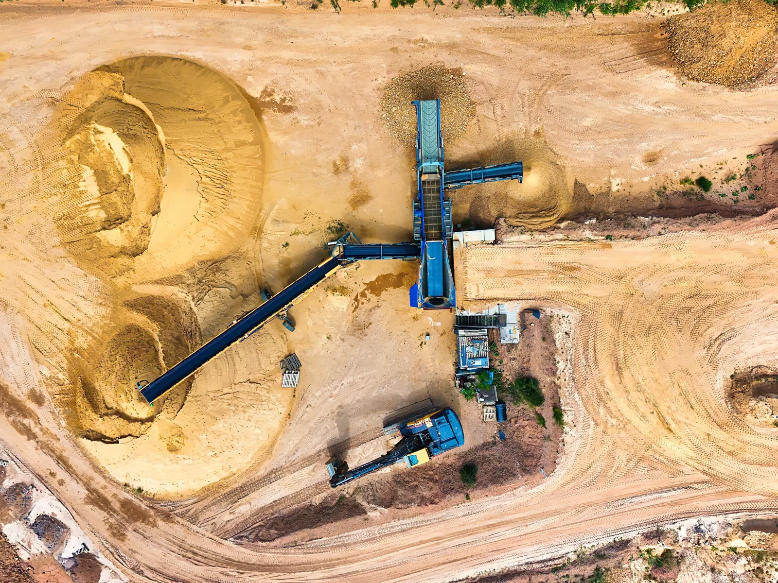
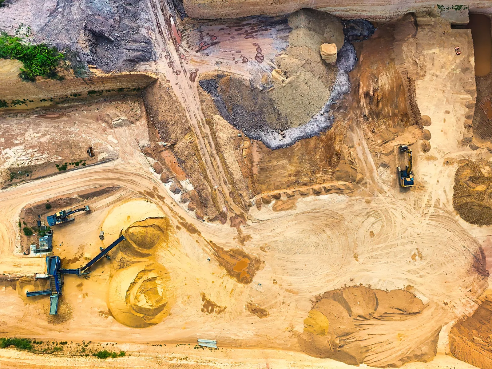
Volumes and tonnage for quarries, aggregate yards and asphalt plants, monthly or on demand.
02Dated, geo-aligned records of pads, roads, containment and tanks, flight to flight.
03Daily, weekly or monthly captures that overlay exactly, plus pre-loss baselines for insurance.
04Gaussian splats, NeRFs, tours and relightable reconstructions for film, architecture and real estate.
05Cinematic aerial video, color-corrected to spec, and geometry placed at true lat/long.
06Step inside a site in a headset, or overlay plans and past captures on the real location.
07Repeat counts and condition records for working land.
Featured work
Selected work and examples of what we deliver.
01 · Case study
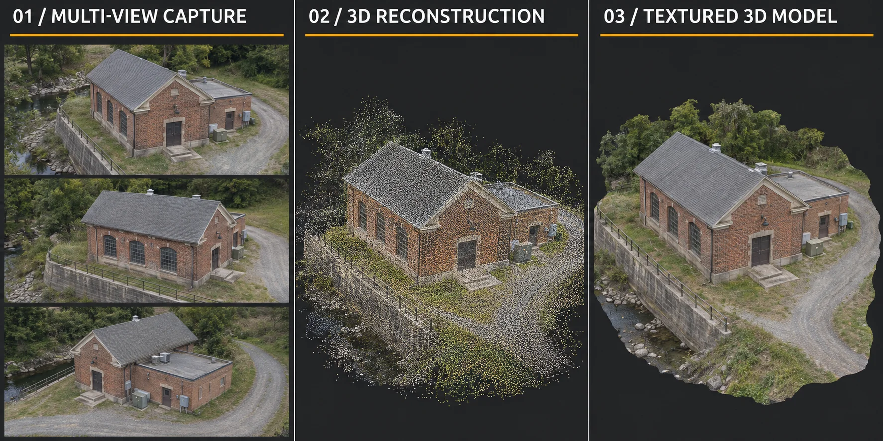
About 400 photographs of Washington's Tavern in Farmington, PA, reconstructed in COLMAP and Metashape into a detailed 3D model. A relightable Gaussian splat version is in progress.
An explorable, photoreal 3D scene.
Working land & infrastructure
Daily or weekly aerial counts to support herd records and feed allowances, plus fence, barn, pond and pasture inspections. Feed and silage pile volumes come from the same flights, so inventory and head counts live in one dated record.
Repeatable counts of drums, totes and aboveground tanks at yards, plants and well sites, mapped by location and compared visit to visit. Visual documentation only; certified tank integrity testing stays with a licensed inspector.
Timber stand, clearing and regrowth records over time, from harvest planning to reclamation. Orthomosaics and canopy models are aligned to real coordinates so year-over-year changes line up.
Corridor progress from clearing and grading through base, paving and striping, plus pre-project condition records of roadway, bridges and right-of-way.
Connected site records
Turn drone and ground photography into a georeferenced 3D record of your site. Revisit it through construction, compare dated captures, inspect remotely, and integrate design overlays or VR walkthroughs. Optional sensor and operational data integration supports an ongoing digital twin.
Explore digital twinsPlan your project
Clear starting prices for every job type. Every quote is itemized: travel, capture, processing and deliverables.
from $950/visit
from $850/pad
from $650
from $595/visit
from $750
from $550
Starting prices within 50 miles of Farmington, PA. Final quote depends on site size, access and deliverables. Monthly programs save up to 20%.
Request a quoteProcess
Tell us the site, what you need to know and how often. We send a quote and a flight plan.
Capture on a repeatable route, with ground capture where drones can't go, under your site's safety rules. Flight work is subject to confirmation of the required pilot certification and insurance.
Photos become aligned 3D models, splats, orthomosaics and volumes, tied to real-world coordinates.
Cleanup, relighting, color grading and compositing, to the standard of a VFX studio.
Reports, exports and browser links. Repeat visits line up exactly with the last.
Simsara Aerial is based in Farmington, PA 15437 and drives to sites within about 300 miles: southwest Pennsylvania, West Virginia, Ohio, Maryland and Virginia, including Pittsburgh, Morgantown, Wheeling and the Marcellus and Utica regions. For larger jobs, we fly in with the gear.
Simsara Aerial is run by Patrick Peluse, with 25 years of experience in visual effects, compositing and color, and 10 years in AI. He covers the whole pipeline himself: capture, reconstruction in Metashape, RealityScan and COLMAP, Gaussian splats and NeRFs, relighting, compositing, color, and alignment to real-world coordinates.
About PatrickBefore we start
The site location, what you want to know (volumes, progress, condition, 3D), how often, and any site safety rules.
Wind, rain and airspace limits can reschedule a flight; we rebook at the next safe window.
No. It's visual documentation, and survey-grade only when tied to ground control or RTK. For a licensed survey, we work alongside your surveyor.
You do. Client imagery is confidential and is used in our portfolio only with your written permission.
Typical turnaround is a few business days after the flight; rush delivery is available.
Part 107 certification and insurance have not been confirmed. Cert # [PART 107 CERT #]. Insurance: [INSURANCE].
Contact
Tell us about the site and what you need. We reply within 1 business day.
Or email info@simsara.com.